The make-up of Innisfil council could be different come 2026, not just with the faces around the table, but also with who they’re representing.
The town is currently in the midst of a ward boundary and council composition review, part of a larger municipal election engagement plan. An ad hoc ward boundary review committee was struck in 2023 which has been tasked with recommending to council the fairest system of representation possible.
The last time ward boundaries were adjusted was in 2009 and with all the changes to the municipality in the past 15 years, this review in long overdue.
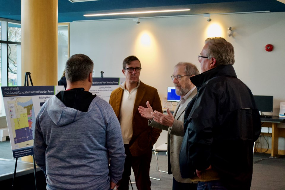
“Now it’s necessary because the numbers are skewed and to have fair and equitable representation, you need to try to ensure your numbers or populations match,” said town clerk Patty Thoma, during a drop-in session on the review at the Innisfil ideaLAB and Library’s Lakeshore branch April 18.
Two virtual sessions take place April 23, for anyone who wishes to get information at the early stages of the review but was unable to attend the in-person session.
The goal for a ward boundary review is for the recommendations to serve the best interests of residents for two to three elections, Thoma said. When she first arrived in Innisfil in 2016, a review for the 2018 municipal election was proposed but ultimately curtailed by the council of the day.
“At that time, there were so many new developments coming online, adding growth and population to areas, that they determined it wasn’t time to do it because if we did it, all of sudden all those extra bodies would put it out of whack,” Thoma said.
The town was in a similar situation while preparing for the 2022 election, however, this time it was deep in the throes of the COVID-19 pandemic. Planned development hadn’t come online in the ways the town anticipated, and while the wards still weren’t equally distributed, it could have been worse.
“The numbers were a little bit off still, but not too far out in some of them,” Thoma said. “If we did that for 2022, we would have to go back to the drawing board; it would not last. And for the cost, and the process of doing it right, let’s do it right. Let’s wait.”
The time for hesitation is through. In an optimum situation, each councillor would represent a ward made up of about 14 per cent of Innisfil’s population, which in 2021 was 43,326. The process for creating the boundaries, however, isn’t as simple as drawing lines around every approximately 6,000 residents and calling it a day.
Ideally, each ward is going to be within plus or minus five per cent of that optimum figure. The research from Watson and Associates, the consultants brought on to undertake the ward boundary review study, shows that in 2016, none of the seven wards met that standard, with Ward 5 being 36 points below and Ward 3 being 67 points above. That means the councillor representing most of the Sandy Cove area likely had a much different experience than the one representing the southern half of Alcona.
“As you can see from what we’ve done already, they vary widely in population,” Dr. Robert Williams, a retired faculty member from the University of Waterloo who has worked with Watson on more the 40 ward boundary studies, said of the current state of the wards.
“In ’21, it was even worse,” he added. “The bigger ones are bigger, the smaller ones are relatively small.”
There was some course correction 2021, thanks to overall population growth — wards 4 and 7 each found their way into the optimum range — but the concentration of the growth has made things more challenging in other wards, such as Ward 2, which accounted for more than half of the entire change in population from the previous census period.
Population numbers are an easy way to visualize the ward makeup, Williams said, which is why they make for a good starting point. From there, the team from Watson will comb through best practices discovered through their work with other municipalities — including Bradford West Gwillimbury, Oro-Medonte and Barrie, locally — along with precedent set through decisions in court cases and from the Ontario Municipal Board or Ontario Land Tribunal (OLT).
The experience of the people on the ground — both from the community and visitors — put the wheels in motion as much as anything else.
“When we look at this system, we’re asking the community to come and have a look at this information and tell us ‘Do you like that? Are there issues? Do you feel you’re fairly represented? Do you feel there should be some change and if so, what should we be looking at?'" Williams explained.
“We’re trying to do this in two stages,” he added. “Is there a problem? What is the problem? And what kinds of things would you see as an improvement on what’s there?”
Willams’ time in the area before being brought on by Watson was limited mostly to driving through on the way up north. However, as part of the review process, he’s been driving the community's roads and getting a feel for its neighbourhoods. Perhaps one of the biggest changes to the ward boundaries the town could see was staring him right in the face as he looked at the window of the Lakeshore branch.
“Look out the window here where we are: Innisfil Beach Road, that’s a boundary,” he said. “It’s been a boundary for years, but in some ways, it’s a spine. It’s a spine of a commercial area, which means it’s not separating. Maybe, they should be joined together.”
That’s another area where members of the public can come into the process and tell the consultants what they feel makes sense, Williams said.
“(It’s) trying to find that beautiful balance where you maintain the important features of each community, that makes them feel they are a community,” Thoma said. “Like, you wouldn’t want to cut Cookstown in half, per se, because then they’ve lost part of that cohesiveness.”
Consultants will take their findings and develop a plan throughout the summer. Following the two virtual information sessions April 23, the consultants have a date with council, where they’ll inform councillors what residents have said so far and hear more from the current ward representatives about how they feel those wards should look come 2026.
And hopefully 2030, as well. With the Orbit looming, that makes this review slightly trickier.
“That’s part of the puzzle as well, planning for (the Orbit),” Thoma said. “My goal (with) this review is to get at least two out of it. For the next election in 2026, the people won’t be there yet. But for 2030, there will be people there. And then when you forecast that out again to 2034, there may be that much more.”
She anticipates three potential alternatives will be made available for public consultation by the end of the summer, giving residents the opportunity to view maps and help make additional refinements.
A final report and recommendation to council is expected in November. Pending appeal to the OLT, if approved the new wards would be in place for the 2026 election.
For more information on the ward boundary review process and to register for the April 23 virtual sessions, click here.


